
Every construction project, infrastructure rollout, and land record in India ultimately rests on one thing: accurate measurement. Whether it’s establishing a property boundary, planning a highway alignment, or mapping utility lines before excavation, the quality of a project depends heavily on the surveying equipment used to gather that initial data.
Over the last decade, surveying equipment in India has shifted significantly from purely optical and mechanical instruments toward satellite-based and digital systems that collect data faster and integrate directly with design and GIS software.
But with more equipment categories and specifications to choose from, buyers are often left wondering which instrument actually fits their project. This guide walks through the types of surveying equipment available in India, their common applications, and the practical factors worth considering before making a purchase.
What Is Surveying Equipment?
Surveying equipment refers to instruments used to measure and map the physical features of land- distances, angles, elevations, and coordinates with the level of precision required for engineering, construction, and legal purposes.
This category spans a wide range of technology, from traditional optical instruments to modern satellite-based positioning systems and 3D scanning devices. What ties them together is their core purpose: converting physical space into accurate, usable measurement data that engineers, planners, and surveyors can work with.
Types of Surveying Equipment in India
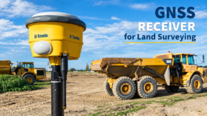
GNSS Receivers Global Navigation Satellite System (GNSS) receivers determine position by receiving signals from satellite constellations such as GPS, GLONASS, Galileo, BeiDou, and India’s NavIC. They’re widely used for covering large areas quickly, particularly where line-of-sight isn’t a limiting factor. Many modern units support RTK (Real-Time Kinematic) corrections for improved positioning accuracy in the field.
Total Stations A total station combines an electronic theodolite (for measuring angles) with an integrated distance meter, allowing surveyors to measure angles and distances from a single setup point. Total stations remain a staple for detail surveys, construction layout, and situations where high precision over shorter distances is required.
RTK GNSS Receivers A specific category of GNSS receiver, RTK units use correction data from a base station or a Continuously Operating Reference Station (CORS) network to refine positioning in real time. This makes them particularly useful for stakeout work, where field crews need immediate, corrected positions rather than post-processed data.
Levels (Automatic and Digital) Used primarily for measuring height differences and establishing elevation control, levels remain relevant for construction grading, foundation work, and drainage design, especially where GNSS signal reliability may be inconsistent.
Machine Control Systems These systems integrate GNSS or total station positioning directly with construction machinery- graders, excavators, pavers, and compactors allowing operators to work to design grade with reduced reliance on manual staking.
3D Laser Scanners Scanning total stations and dedicated 3D scanners capture dense point clouds of a site or structure, useful for as-built documentation, monitoring, and complex structural surveys where traditional point-by-point measurement would be too slow.
Ground Penetrating Radar (GPR) and Geophysical Instruments For subsurface investigation- utility detection, geotechnical assessment, and geological studies- GPR and related geophysical equipment provide data that surface-level surveying instruments simply can’t capture.
Marine and Hydrographic Survey Equipment For coastal, port, and waterway projects, specialized equipment such as multibeam echosounders and positioning systems designed for marine environments are used to map underwater terrain and support offshore construction.
Applications of Surveying Equipment
Surveying equipment supports a wide range of professional activities across India’s infrastructure and construction landscape:
- Land and cadastral surveys – establishing legal boundaries and supporting land records
- Topographic surveys – capturing terrain and elevation data for design and planning
- Construction layout and stakeout – translating design drawings into physical reference points on site
- Infrastructure projects – roads, railways, pipelines, and utility corridors that require control over long distances
- Mining and quarrying – volumetric calculations and site monitoring
- Urban and smart city planning – base mapping for municipal and development projects
- Marine and coastal projects – hydrographic surveys for ports, dredging, and offshore infrastructure
- Monitoring applications – tracking structural movement, subsidence, or slope stability over time
Key Features to Consider Before Buying
Accuracy Requirements Different projects call for different accuracy tolerances. A cadastral survey may demand a different level of positional precision than a preliminary topographic survey buying beyond what a project genuinely requires often adds cost without added benefit.
Environmental Suitability Equipment that performs well in open, rural terrain may face challenges in dense urban environments or under heavy tree cover, where satellite visibility is reduced. Consider where the equipment will actually be used most often.
Connectivity and Correction Sources For GNSS-based equipment, check whether reliable CORS networks or network RTK correction services are available in your operating regions, since correction infrastructure varies across India.
Durability and Build Quality Fieldwork means exposure to dust, heat, monsoon rain, and general rough handling. IP-rated housings and rugged construction matter for equipment that will see regular field use.
Battery Life and Power Options Long field days require dependable battery performance, and hot-swappable battery systems can reduce downtime on multi-day projects.
Software and Data Compatibility Ensure the equipment integrates with the field controllers, data collection software, and office processing tools your team already uses or is planning to adopt- to avoid workflow disruptions.
After-Sales Support Surveying equipment requires periodic calibration, firmware updates, and occasional repair. Availability of local service and training support can significantly affect the equipment’s long-term usability.
How to Choose the Right Surveying Equipment
Selecting the right equipment generally comes down to matching instrument capability to actual project needs:
- Define the survey type and required accuracy before evaluating specific models.
- Assess the working environment- open land, dense urban areas, underground utilities, or marine sites all call for different equipment categories.
- Considering project scale and frequency of use, occasional use may not justify premium equipment, while continuous field operations may benefit from more robust, higher-capacity systems.
- Factor in total cost of ownership, including calibration, servicing, software licensing, and eventual equipment upgrades, not just the upfront purchase price.
- Evaluate the supplier, not just the product technical support, training, and spare parts availability often matter as much as the equipment specifications themselves.
GNSS Receiver vs Total Station
This is one of the most common questions among surveyors evaluating new equipment, and the honest answer is that the two instruments generally serve different purposes rather than competing directly.
GNSS receivers excel at covering large, open areas quickly without requiring line-of-sight between points, making them well suited to boundary surveys, topographic mapping, and infrastructure corridors. Total stations, on the other hand, offer high precision over shorter ranges and continue to perform reliably in GNSS-denied environments- dense forest, urban canyons with tall buildings, tunnels, or indoor spaces where satellite signals are unreliable or unavailable.
In practice, most professional survey teams use both instruments as complementary tools: GNSS for rapid, wide-area data collection, and total stations for detailed work, verification, and situations where satellite visibility is compromised. Choosing one exclusively over the other is rarely necessary, and the right combination depends on the specific mix of projects a team typically handles.
Benefits of Professional Surveying Equipment
Investing in professional-grade surveying equipment, rather than consumer-grade alternatives, generally offers several practical advantages:
- More consistent performance across varying field conditions
- Better support for industry-standard data formats and coordinate systems
- Stronger integration with common survey, CAD, and GIS software
- More rigorous build quality suited to repeated field use
- Access to manufacturer support, firmware updates, and accessory ecosystems
That said, equipment alone doesn’t guarantee results – proper training, correct methodology, and appropriate correction sources remain essential to getting accurate, reliable data in the field.
Why Choose a Professional Survey Equipment Supplier?
Purchasing surveying equipment is rarely a one-time transaction- it’s the beginning of an ongoing relationship that includes calibration, servicing, training, and troubleshooting as projects evolve. A professional supplier can offer meaningful advantages over purchasing equipment through unsupported channels:
- Guidance on selecting equipment suited to actual project requirements
- Installation, configuration, and hands-on field training
- Access to local service centers for calibration and repairs
- Ongoing technical support when field issues arise
- Awareness of firmware, software, and correction service updates as technology evolves
Given how frequently GNSS correction infrastructure, software platforms, and equipment firmware are updated, working with a supplier who stays current on these changes is often as valuable as the equipment itself.
Why Choose Spry India?
Spry Technocon is a survey equipment supplier in India, offering GNSS receivers, total stations, machine control systems, marine survey solutions, and geophysical instruments to professionals across the country. As an authorized technology partner for established brands including Trimble, along with Teledyne, Klein, VideoRay, and other specialized manufacturers, Spry India works across a broad range of survey equipment categories rather than a single product line.
What sets a supplier apart, though, isn’t just the range of equipment on offer- it’s the support behind it. Spry India’s Service & Support offering includes dedicated service centres, field services, data prep services, and training services, backed by a nationwide presence across Gurugram, Mumbai, and Hyderabad. This means survey teams working with Spry India get help not just at the point of purchase, but through installation, calibration, and ongoing use, which matters considerably once equipment is out in the field on a live project.
For teams evaluating GNSS receivers, RTK-capable systems, total stations, or machine control solutions, working with a supplier that offers both equipment breadth and dependable after-sales support can meaningfully reduce downtime and uncertainty over the life of a project.
Frequently Asked Questions
What is the most commonly used surveying equipment in India?
GNSS receivers and total stations are among the most widely used instruments across land surveying, construction, and infrastructure projects in India, often used together depending on project requirements and site conditions.
What is the difference between a GNSS receiver and a total station?
A GNSS receiver determines position using satellite signals and is generally faster for covering large, open areas. A total station measures angles and distances from a fixed setup point using an integrated theodolite and distance meter, offering high precision over shorter ranges and reliable performance where satellite signals are obstructed.
What is an RTK GNSS receiver used for?
An RTK GNSS receiver applies real-time correction data from a base station or CORS network to improve positioning accuracy in the field, making it useful for construction stakeout and other applications requiring immediate, corrected positions.
How do I choose the right surveying equipment for my project?
Consider your required accuracy, working environment, project scale, correction infrastructure availability, software compatibility, and the level of after-sales support offered by your equipment supplier, rather than selecting equipment based on specifications alone.
Are GNSS receivers accurate enough for all types of surveys?
Accuracy depends on the receiver, correction method, satellite visibility, and environmental conditions. For dense urban areas, indoor spaces, or heavily obstructed sites, a total station may be more reliable, which is why many survey teams use both instruments depending on the task.
Do surveying equipment suppliers in India offer training and after-sales support?
This varies by supplier. Established suppliers typically offer installation support, field and classroom training, calibration services, and ongoing technical assistance, which can significantly affect how effectively a team uses its equipment over time.
Conclusion
Choosing the right surveying equipment in India isn’t about picking the most advanced or expensive option available- it’s about matching instrument capabilities to the actual demands of your projects, working environment, and team’s workflow. GNSS receivers, total stations, machine control systems, and specialized instruments like GPR and marine survey equipment each serve distinct purposes, and most professional survey operations rely on a combination of tools rather than a single instrument. Equally important is the supplier behind the equipment- ongoing calibration, training, and technical support often determine how reliably that equipment performs over years of field use, not just on the day it’s purchased.